I used to live in Napa County and I always thought that looked like a short stretch along Hwy. 12 in Sonoma County. I traveled that road fairly frequently, and it sure looked familiar. I remember remarking to friends that it looked like those hills just west of the Clover Stornetta Dairy (which places it pretty well for anyone from the area). Interesting now to find that I was right! I never gave serious thought to whether it actually was that stretch, as it is nondescript enough to have been from many places, even other places in Sonoma County.
I always remembered that stretch because it was very pretty with the road curving through and dairy cows on the hillsides, but what really stuck in my mind was that unlike most everywhere else along that part of the road, those few hills had no trees on them, and one time when they had just been disc plowed before being planted, the strong contour lines of the furrows and the varying colors of the moist earth drying were such a delightful sight I had to stop just to take it in.
Funny how inexact memory can be sometimes- O'Rear describes and mimes cranking the RZ67. I'll bet later he was thinking about it and went "D'oh!"
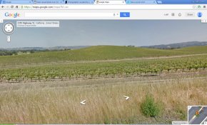
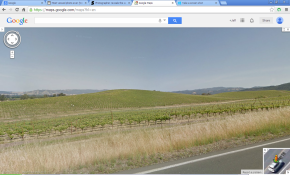
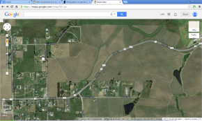
A few Streetview shots of it (the angle is of course much higher from the Streetview car):


The left image is very close to the spot along the road from which it was taken.
The middle image is a short distance away, but I think it gives more of the feel of the XP picture.
The third image places it on the map-- the spot it was taken is in the center just about where the 12 in the white oval is, and looking northwest. The green sqiggly line just to the left of center is the swale at the foot of the hill, clearly visible in the XP picture.


 In all seriousness though I probably have some pretty dark humor....


